





Exploring the Latest PropertyIntel Features
NEW — Map Metadata & Custom Fields on Projects
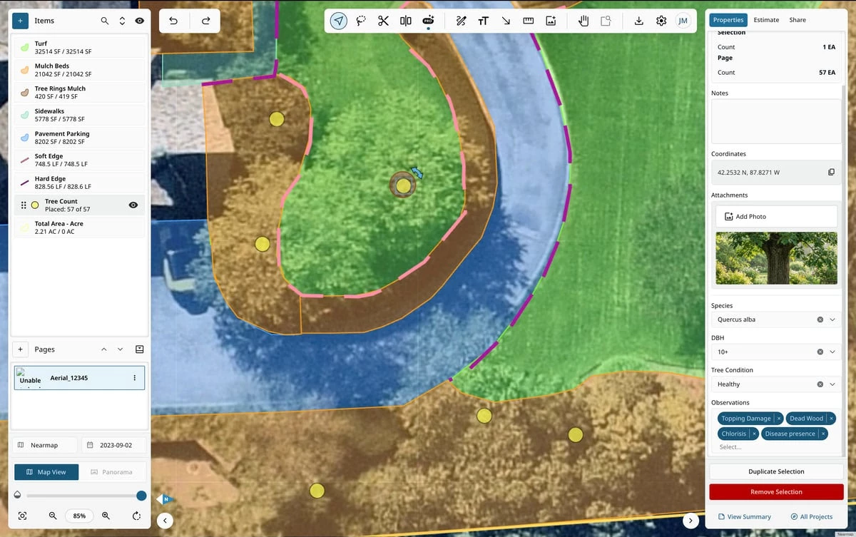
Capture site-specific details condition notes, material specs, zone labels directly on every drawing, line, and placed object during takeoff, and reuse them project after project.
-
Custom Fields, Your Way: Build text, single-select, and multi-select fields that show up right in the properties panel.
-
Bundle & Reuse: Group related fields into a set (like "Tree Care") and apply the whole bundle to a catalog item in one click instead of adding fields one by one.
-
Configure Anywhere: Set custom fields at the catalog level for org-wide standards, or adjust them on the fly inside a project without touching the global template.
-
Reference Photos: Attach photos directly to any item or material on the map so your team can see exactly what's in the field.
NEW — Public API (Early Access)
Connect PropertyIntel to the rest of your business. Our new Public API gives Enterprise+ organizations secure, programmatic access to projects, properties, quantities, catalog items, and more.
-
Programmatic Access: Pull and create Projects, Properties, Quantities, Catalog Items, Users, Branches, and Reference Maps straight from your own systems.
-
Secure, Rotatable Credentials: Generate, revoke, and regenerate API credentials any time.
-
Documentation That Keeps Up: A publicly hosted API reference covers authentication, every endpoint, and error handling, so your developers can get integrated fast.